BY KAVITA NAGPAL
Taking forward from our previous blog on ‘Artificial Intelligence (AI) in the Indian Defence Sector’ https://thedefencespace.com/2023/06/21/part-5-of-the-series-artificial-intelligence-ai-in-the-indian-defence-sector/, in this blog post we will be covering few more AI-Technologies under Command, Control, Communications, Computer and Intelligence, Surveillance and Reconnaissance Systems (C4ISR) Systems – that are being indigenously developed or developing by the India’s Defence Industrial Base (DIB).
Refer the below given Image.
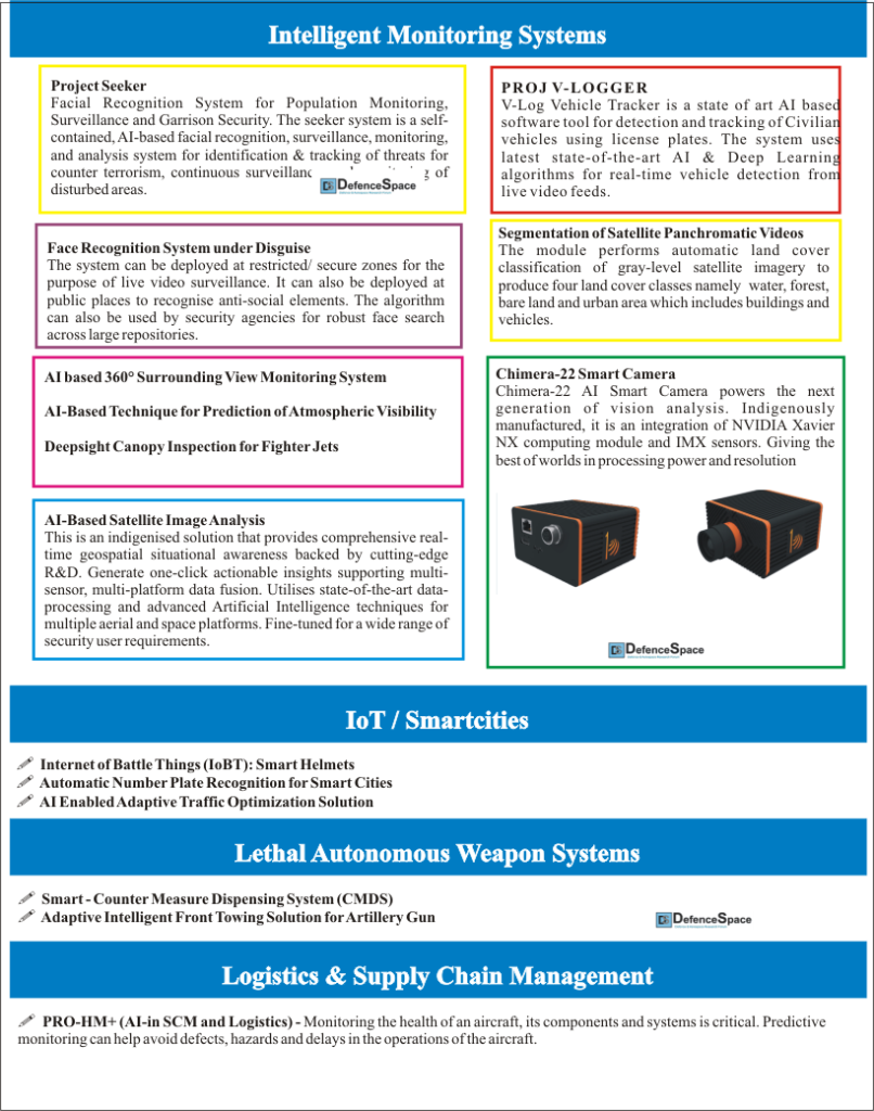
I. Intelligent Monitoring Systems
Project Seeker – Facial Recognition System for Population Monitoring, Surveillance and Garrison Security
The seeker system is a self-contained, AI-based facial recognition, surveillance, monitoring, and analysis system for identification & tracking of threats for counter terrorism, continuous surveillance, and monitoring of disturbed areas.
Additionally, the system can be employed for ensuring state-of-the-art security of critical military/civilian establishments and monitoring at border-crossing points.
The AI-powered analytics module enables processing of Intelligence data from various sources to identify and track movement of terrorists and anti-national elements aided by accurate information collection.
Application of System:
- Counter Terrorism,
- Threat Monitoring,
- Creation of Secure Zones,
- Monitoring of Disturbed Areas,
- Intelligence Analysis,
- Border Monitoring,
- Secure Places of Strategic Importance
Unique Features:
- Indigenously Designed, Developed, and Deployed
- No Internet Connection Required
- Proprietary Data Security Layer
- State of Art AI Deep Learning Facial Recognition Algorithm
- Combined Intelligence Data Capture and Analysis System
- Able to Operate in Wide Range of Environmental Conditions
- Continuity and shareability of Intelligence Data
2. PROJ V-LOGGER – V-logger Vehicle Tracking System
Weaponising the vehicle has been an emerging trend amongst the Antinational Elements in the recent past. The Pulwama attack of 2019 is one of the recent incidents that shows such a trend.
Despite deliberate measures, identity of a suspicious vehicle remains a challenge to the units / formations deployed on active duty.
As there is a need to build an AI-based Suspicious Vehicle Detection System which can automatically identify a vehicle based on its license plate and extract the identity of the vehicle which can serve as a decision support system with an aim to enhance human capability and efficiency of troops deployed at vehicle check posts.
The innovation is equipped to work on any existing camera inputs like webcam, bullet cameras, dome cameras etc.
V-Log Vehicle Tracker is a state of art AI based software tool for detection and tracking of Civilian vehicles using license plates.
The system uses latest state-of-the-art AI & Deep Learning algorithms for real-time vehicle detection from live video feeds. The system is capable of identifying individual vehicles from moving traffic in real time.
It extracts the vehicle info to include number plate, make, model, colour etc., on-the-fly and corroborates the details with registered formation vehicle database for cross matching the identity of the vehicle.
The system is also capable of raising an auto alarm in case of any identity mismatch in vehicle credentials amounting to suspicion.
Salient Features.
- High Accuracy. Supports standard and non-standard Indian number plates with detection accuracy over 90%.
- Two/Four-Wheeler Sp. V-Logger System features seamless no plate recognition of two/four-wheeler non-std number plates.
- Detection on Moving Traffic. System is Capable of detecting the number plates on real-time continuous fast-moving traffic.
- Network deployment. V-Logger supports multiple cameras over a network to cover a stretch of road.
- Analytics & Insights. The analytics capability helps to gain more depth insights on moving pattern of vehicles over an Area of Responsibility.
- Blacklisting & Manual Entry. Facility to blacklist a known illegitimate vehicle based on intelligence / civil police inputs.
- CPU Optimized. The system is optimized to work in a normal desktop/laptop without the support of a dedicated GPU machine as compared to former version.
3. Face Recognition System under Disguise
‘Face recognition in the wild’ on surveillance camera feeds is a difficult problem to solve due to the low resolution of the images captured from the cameras.
This problem becomes even more challenging to solve with the added complexity of various facial disguises, crowd occlusions and varied illuminations. Face Recognition System under Disguise (FRSD) aims to solve these challenges.
The objective of FRSD is to develop a system which can be used to identify anti-social elements with or without disguise in low-resolution surveillance camera feeds.
The algorithm has been trained in such a way that the face recognition system can see through several disguises like face-masks, beard, moustache, wigs, sunglasses, head-scarves, monkey caps, hats, etc.
Apart from the disguises, the system also considers different lighting conditions, shadows on face, crowd occlusions, etc.
The system can be deployed at restricted/secure zones for the purpose of live video surveillance. It can also be deployed at public places to recognise anti-social elements.
The algorithm can also be used by security agencies for robust face search across large repositories.
The system is designed to ensure scalability across multiple GPUs and servers. In addition, the system is optimized to ensure maximum utilization of GPUs and thus can support multiple surveillance cameras on a single GPU. The system comes with a flexible video analytics suite with number of additional surveillance applications like people counting, geo-fencing, fire detection and collision detection.
4. Segmentation of Satellite Panchromatic Videos
The module performs automatic land cover classification of gray-level satellite imagery to produce four land cover classes namely – water, forest, bare land and urban area which includes buildings and vehicles.
It is able to segment a panchromatic image using only intensity information into four different land cover types. Accurate classification of even very small areas (15×15 pixels) in the satellite image is achieved through multiple level texture analysis using a state-of-the-art machine learning algorithm.
The same method is capable of scenario classification in panchromatic as well as Google Earth images.
This solution has been successfully deployed in the Battlefield Surveillance System (BSS) for surveillance of border regions. This aids the defence personnel to quickly identify any remarkable changes in the border regions based on satellite images.
It caters to panchromatic images with different types of land cover classes and can be used in different video surveillance applications.
5. AI based 360° Surrounding View Monitoring System
Operator visibility can be limited due to blind spots around over-sized machines, often made worse by the harsh working environment; terrain, weather or low light.
40% of fatal accidents on quarry sites are caused by moving vehicles and 70% of collisions occur at low speed because of poor visibility.
Mirrors and single-view cameras help to see blind spots, but even with this extra assistance, the driver may still not see everything in the vehicle’s path.
An AI-based 360-degree, intelligent camera monitoring system assist low-speed maneuvering by providing the driver with a complete surround view of the vehicle in real time.
The system works with four ultra-wide-angle cameras that each covers one full side of the vehicle with a viewing angle of over 180°. High-mounted on the front, rear and sides, the calibrated cameras capture all of the surrounding area including the blind spots of the vehicle.
The four live images are simultaneously sent to an electronic control unit (ECU) where they are instantly processed, combined, blended and stitched.
The distortion from the wide-angle camera lens is also corrected before delivering a clear, single, smooth, real-time image onto the driver’s monitor.
The system has an in-built digital video recorder and images/video can be viewed later for analysis in case of any accidents/operational issues.
It can be integrated with Radar based proximity warning system. The system will alert the operator to view the camera whenever any objects/persons are detected.
6. HUMS Ground Station
Health and Usage Monitoring System (HUMS) for Helicopter Maintenance has been developed for performing Condition Based Maintenance (CBM) instead of Fixed Time before Overhaul (TBO) based maintenance.
The system uses recorded vibration data onboard the helicopter and processes it to compute various Condition Indicators (CIs). These Condition Indicators are then used by the AI-based algorithm to compute the Remaining Useful Life (RUL).
Unique Features:
- Replaces Time before Overhaul (TBO) based maintenance with Condition Based Maintenance (CBM) based on Remaining Useful Life (RUL).
- Results in reduction in unplanned downtime of the helicopter; thereby enhancing fleet availability.
- Adaptable to other helicopter platforms like LUH, LCH etc.
7. AI-Based Satellite Image Analysis
This is an indigenised solution that provides comprehensive real-time geospatial situational awareness backed by cutting-edge R&D. Generate one-click actionable insights supporting multi-sensor, multi-platform data fusion.
Utilises state-of-the-art data-processing and advanced Artificial Intelligence techniques for multiple aerial and space platforms. Fine-tuned for a wide range of security user requirements.
8. AI-Based Technique for Prediction of Atmospheric Visibility
Knowing and having access to meteorological data is extremely vital to the Armed Forces.
This solution by Puzzles, predicts real-time, location-based visibility forecasting. The technology uses METAR data along with satellite and meteorological data based on latitude, longitude and altitude.
Meteorological data like temperature, precipitation, relative humidity, wind speed, wind direction, visibility and particulate matter (PM10, PM2.5, etc.) would be correlated with the visibility range.
Using a statistical concept called time series and ML algorithms, visibility forecasts can be predicted in real time. Long and short-term memory (LSTM) networks are a version of recurrent neural networks (RNN), that make it easier to remember past data in the memory. LSTM is well suited to classify, process and predict time series for a given time lags of unknown duration.
9. Chimera-22 Smart Camera
Chimera-22 AI Smart Camera powers the next generation of vision analysis. Indigenously manufactured, it is an integration of NVIDIA Xavier NX computing module and IMX sensors. Giving the best of worlds in processing power and resolution.
Unique Features:
- Edge AI Capability
- Plug N Play
- Cloud Connectivity
- Real-time compute capability
- Customisable Dashboard
- Smooth 3rd Party Integration
Vision Applications:
• Security & Surveillance
• Access control & usage charging
• Product quality inspection
• Defence Applications
• Drone Detection
• Robot Guidance
• Metrology
• Post-facto video analysis for claim adjudication / crime investigation.
• Intrusion Detection
• Edge AI enabled, rugged military grade Smart Camera which is designed & manufactured Indigenously in India for defence applications
10. Deepsight Canopy Inspection for Fighter Jets
Deepsight is an AI-based machine vision system for automatic inspection of surface defects. Manual inspection and grading are more subjective and error-prone and not suitable for large number of items to be graded.
Deepsight is the first deep learning-based cosmetic inspection and grading system that provides the end user with accurate and flexible inspection operating and grading methodology.
Unique features:
- Inspects fighter aircraft canopy for clear visibility to the pilot
- AI system identifies and measures Glass Silvering and other defects such as cracks, dents and scratches on the canopy
- The system can measure the depth of the dents with up to nanometer precision
- The system allows Supervisors to set criteria for Pass and Fail of the canopy.
- SCIS provides accurate and dependable evaluation data
- Ruggedised monitoring system
Key Benefits:
- Consistent and accurate grading of aircraft canopies as per defined criteria
- Eliminate subjectivity involved in manual grading operations
- Laser Inspection system should get coordinates from the Optical inspection system
- Configurable solution to suit product size and defect specifications
- Optical inspection system scans the surface of the Canopy using Camera.
- Deep learning algorithm for continuous improvement
II. IoT / Smartcities
1. Internet of Battle Things (IoBT): Smart Helmets
The urban combat scenario is always challenging due to its constrained space of operation and the sheer unknowns of the area of operation.
Hence, any form of real-time situational awareness increases the chances of success manifold. To address this need for real-time situational awareness the “Smart Helmet” can capture the 3D information of any unknown environment in real time and assist in various decisions.
The “Smart Helmet” comprises of an optical sensor mounted on the helmet of an active combat soldier which in turn is connected to a wearable backpack computer of small form factor.
The sensors capture the 3D information of the environment in real time and the software (running on the computer) using an Artificial Intelligence algorithm, generates a 3D map of the same environment.
From the generated 3D map semantic locations of various entities (doors, windows, gates etc) inside the unknown environment can be determined along with their approximate dimensions.
This information helps in deciding entry and egress points of an unknown environment.
In addition to this, the generated 3D map can serve as a “Local Positioning System” for conflicted and remote areas where we might have “No GPS” or “Low GPS” scenario.
With the help of the “Smart Helmet”, members of a combat team or search and rescue team can precisely determine their own 3D positions in real time.
This positioning system has an accuracy of less than 100 cm and has no dependency on external sources e.g., GPS. The positional information of each multiple combat agent wearing the “Smart Helmet” are relayed to a central command center at a rate of 10Hz using a wireless backbone.
This helps in tracking multiple combat agents inside an unknown environment thereby creating a comprehensive situational awareness for decision making.
2. Automatic Number Plate Recognition for Smart Cities
Automatic Number Plate Recognition (ANPR) technology is indigenously developed with a high accuracy for Indian vehicles. The system is able to detect and recognise licence plates of different types of vehicles like two-wheelers, auto rickshaws, cars, trucks, buses and military vehicles from the live traffic feed captured by ANPR camera operating on a day-night basis.
This is an end-to-end solution including vehicle image acquisition, real-time recognition of licence plate and storing relevant vehicle details in a central repository. It can be deployed on edge devices as well as a centralised server as required. The ANPR module is an integral part of Smart City solutions provided by BEL.
ANPR finds several diverse applications such as access control, parking management, tolling, user billing, traffic management, policing and security services, red light and lane enforcement. It helps in automating vehicle inspection systems and traffic management systems.
Thus, it helps in ensuring security and enabling a hassle-free life for citizens.
3. AI Enabled Adaptive Traffic Optimization Solution
In the current scenario of smart cities and connectedness, the world is looking forward to new AI-based traffic analytics and management system that enables governments and Department of Transportation, to autonomously monitor growing traffic.
Traffic congestion is an ever-increasing, non-productive problem in towns and cities around the world. Further, it reduces regional economic health.
Hence, there exists a need for adaptive traffic control solutions that help smart cities move towards faster response to accidents, improve transportation infrastructure and reduce congestion.
In this direction, BEL developed a comprehensive AI-enabled Collaborative Multi-Agent Reinforcement Learning based adaptive traffic optimisation solution that aims to reduce travel time and delay at traffic signals and also to minimise the average waiting time throughout the network of traffic signals.
This solution is capable of adjusting signal timing parameters in response to traffic fluctuations in multi-agent networked junctions.
It can be deployed at traffic junctions as part of Smart City Implementation.
III. Lethal Autonomous Weapon Systems
1.Smart – Counter Measure Dispensing System (CMDS)
CMDS protects aircraft / helicopters against incoming Infrared / Radar guided missile threats by dispensing payloads (Flares / Chaffs) based on the inputs received from various sensors installed on aircrafts.
What does SMART-CDMS do? When the aircraft flies over an enemy territory, which is prone to attacks, SMART-CMDS automatically dispenses appropriate type and number of payloads in a suitable sequence against active threats, based on the inputs available from the sensors and mission computer.
While dispensing suitable firing programs against active threats, SMART-CMDS records the relevant firing data along with the geographical position which will be later invoked to decide suitable firing sequence in that particular location to preempt previously known threats.
SMART-CMDS will learn over a period of time to dispense payloads intelligently while passing over such threat locations in future sorties.
2. Adaptive Intelligent Front Towing Solution for Artillery Gun
This particular system provides synchronization of speed-dependent and turning radius dependent movement between a driver component and a driven component.
Gun can negotiate hair pin bend with ease.
It provides controlled motion to gun while negotiating turn.
Reliable and redundant solution.
Overall structural weight for towing arrangements has been reduced.
Features:
- With proposed configuration turning circle radius equal to and less than towing vehicle alone has been achieved.
- Road width required drastically reduced than earlier configuration.
- Can be used in any terrain with side and ground slopes.
III. Logistics & Supply Chain Management
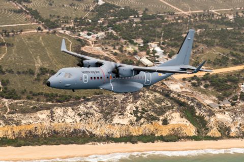
1.PRO-HM+ (AI-in SCM and Logistics)
Monitoring the health of an aircraft, its components and systems is critical. Predictive monitoring can help avoid defects, hazards and delays in the operations of the aircraft.
The current practice of conventional, condition-based monitoring practices can provide information about a defect only after its occurrence. This can prove to be ineffective and could lead to unsafe operation of the aircraft.
It is, therefore, necessary to identify a method to monitor the health of the aircraft components and system to avoid an impending failure before occurring.
ProHM+ is an AI based in Aircraft Health Monitoring software product that used data analysis techniques to identify trends, patterns, and relationships, which will enable prediction of aircraft behavior, equipment failure and other future events.
ProHM+ converts acquired data into operational and business intelligence.
Descriptive, predictive, prescriptive and prognostic layers of data analytics monitor the trend of operation and predict the maintenance requirement with a high confidence level. This can maximize the uptime of the asset and reduce the total cost of ownership.